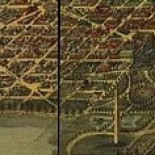
Hopkins real estate maps (1887 and later) offline at DCPL’s DigDC website — DCRA Surdocs alternative
Hopkins real estate maps (1887 and later) offline at DCPL’s DigDC website — DCRA Surdocs alternative DiGDC https://digdc.dclibrary.org/ The 1887 and later Hopkins atlases are offline currently (they are not … Continue reading

Where did Washington DC’s 1950 Population of 800,000 Live?
Where did Washington DC’s 1950 Population of 800,000 Live? By Matthew B. Gilmore COMPLETE COLUMN here: intowner.com/2018/07/31/where-did-washington-dcs-1950-population-of-800000-live/ RESOURCES https://matthewbgilmore.wordpress.com/what-once-was-where-did-washington-dcs-1950-population-of-800000-live/ In 1950 the United States federal census recorded the population in the District … Continue reading

The D.C. Underground Atlas
Interesting map/GIS project see: https://www.washingtontunnels.com/ The D.C. Underground Atlas Underground passageways are a recurring plot device in fictional stories set around Washington. Something about tunnels and the government appeals … Continue reading

The City of Our Hopes and Desires: Zoning Comes to Washington DC
By Matthew B. Gilmore For complete article click: http://intowner.com/2016/10/26/the-city-of-our-hopes-and-desires-zoning-comes-to-washington-dc/ It had a curious beginning. The tale begins with a bit of a mystery: The August 21, 1916 Evening Star reported that … Continue reading

Kidwell’s gambit: One man’s gamble and the creation of Potomac Park
“Kidwell Meadows — riverfront views!,” contemporary advertisements might have read had John Kidwell’s bold real estate gambit succeeded. His attempt failed but the federal government’s long legal efforts to quash … Continue reading

New Zoning for the District of Columbia – September 6, 2016
New Zoning for the District of Columbia Comparison maps/new and old overlaid (PDFs): Ward 1 Zoning [pdf] Ward 2 zoning [pdf] Ward 3 zoning [pdf] Ward 4 zoning [pdf] Ward 5 zoning [pdf] Ward 6 … Continue reading

“High-handed usurpation and outrage”: The End of Washington City Canal
Benjamin Severson was incensed. The work he’d devoted so much time and energy into had been undone. Despite many critics, Severson, a civil engineer and foreman under Montgomery Meigs for … Continue reading

Welcome Pierre Reception & Toast-March 9, 2016
March 9 @ 6:30 pm–9:00 pm | $30.00 The 28th Annual Welcome Pierre! Reception & Toast Wednesday, March 9, 2016 6:30-9:00 in the evening Dower House – Tudor Place 1670 31st Street, NW Washington, … Continue reading

Map of Location of Garfield Shooting
Map of Location of President Garfield Shooting Map indicating location of shooting of President James A. Garfield (click to enlarge) showing current buildings and roads superimposed over an 1880s map. … Continue reading

Talk Dec 17, 2015-Mapping the Permanent System of Highways – DC’s “Second L’Enfant Plan”
DC’S “SECOND L’ENFANT PLAN” – THE PERMANENT SYSTEM OF HIGHWAYS Little-known 1893/98 Master Plan Guided Upper DC’s 20th Century Development Thursday December 17, 2015. Evening lecture by Washington Map Society. Held at … Continue reading
